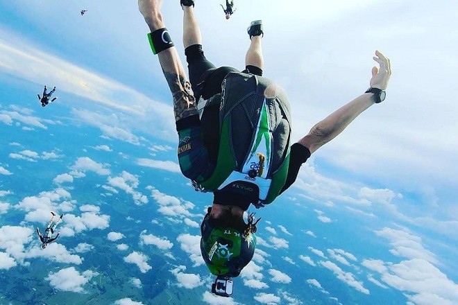
- GNSS-enabled altimeter helps improve situational awareness, safety decisions in freefall
- “A stable hardware platform enhanced by regular firmware updates will make the SmartAlti to get better and better”
 U-blox has announced that its GNSS (Global Navigation Satellite System) technology is being used in a smart altimeter for skydivers, paragliders, wingsuit pilots and other aerial athletes.
Dekunu Technologies’ Dekunu One SmartAlti is a body-worn altimeter that provides a similar quality of information about a user’s altitude and position in the sky as pilots receive in their cockpits. A large, clear display ensures that skydivers can always access that information easily. This helps with their situational awareness and enables them to make smarter decisions about their own and fellow skydivers’ safety during freefall.
About the Launch
“Among the key design considerations for the SmartAlti were the ability to access multiple GNSS constellations to ensure we had access to as much positioning data as possible, and to update that data at high speed,” said Chandler, Dekunu’s Founder. “We also wanted all this done at low power. Many suppliers were evaluated and the u-blox GNSS chips came out on top.”
Jason Meilhon, Senior Business Development Manager at u-blox, said: “We’re delighted to be helping Dekunu Technologies make skydiving safer and more fun for all. The combination of our best-in-class GNSS technology and Dekunu’s commitment to a stable hardware platform enhanced by regular firmware updates, means the SmartAlti should just keep getting better and better.”
About SmartAlti
The SmartAlti also includes Wi-Fi, Bluetooth and USB facilities. Wi-Fi is used to sync the device to a cloud service, through which users can log and share the data that the SmartAlti has gathered during their freefalls. This service also includes mesmerizing 3D visualizations of the users jump data. Wi-Fi is also used to enable over-the-air firmware updates.
Bluetooth is currently disabled but Dekunu is exploring using the facility to enable the creation of ad hoc mesh networks between groups of skydivers in their jump aircraft. This would enable them to share up-to-date positioning data from a user at a window to other users whose altimeters would otherwise be shielded by plane’s metal fuselage. The USB port is used for charging and diagnostics.
About U blox
U blox is a global technology leader in positioning and wireless communication in automotive, industrial, and consumer markets. Their smart and reliable solutions, services and products let people, vehicles, and machines determine their precise position and communicate wirelessly over cellular and short range networks.
With a broad portfolio of chips, modules, and secure data services and connectivity, u blox is uniquely positioned to empower its customers to develop innovative and reliable solutions for the Internet of Things, quickly and cost effectively. With headquarters in Thalwil, Switzerland, the company is globally present with offices in Europe, Asia, and the USA.
About Dekunu Technologies
Dekunu Technologies was started by Brent Chandler, a skydiving and technology enthusiast based in Australia. Chandler couldn’t find a product that provided all the information he felt he needed during a skydive, and so decided to build his own. After 11 rounds of prototyping using best-in-class components he came up with the hardware platform for a smart altimeter. The SmartAlti is on sale with a rich feature set that brings cockpit-class information to today’s skydivers. It will be refined over the long term using firmware updates to add features.


